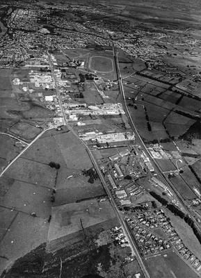
Photograph - Aerial View Of Te Rapa Area 1965
Maker
Waikato Times
Production date
Nov 1965
Description
Black and white glossy aerial view photograph of the Te Rapa area in 1965. Houses at the bottom right are the RNZAF Base quarters (now demolished). The road on the left of the base was the Great South road to Auckland. Te Rapa race track is in the foreground. The road on the left is Pukete Road.
See full details


Public comments
Be the first to comment on this object record.