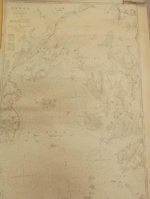
Chart - Middle Part Of Hirosima Wan (Japan)

Maker
Unknown
Production date
Circa 1933
Description
Cartographic chart of the middle part of Hirosima (Hiroshima) area. At top Left Hand corner of chart reads: Surveys of the Imperial Japanese Navy to 1926 with additions from other sources to 1933.
See full details

Object detail

Maker
Production date
Circa 1933
Media/Materials
Paper
Measurements
1074 x 765 mm (h x w)
Production place
Collection
Department collection type
Credit line
Collection of Waikato Museum Te Whare Taonga o Waikato
Accession number
1961/28/9

Share

My shortlist

Object type

Subject auto tags

Explore other objects by colour

Public comments

Be the first to comment on this object record.

Google reCaptchaThis site is protected by reCAPTCHA and the Google Privacy Policy and Terms of Service apply.