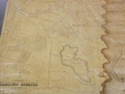
Map - Plan Of Hamilton Borough 1920's

Maker
Department of Lands and Survey Wellington NZ
Production date
Circa 1920
Description
Wall map titled: "Plan of Hamilton Borough".
See full details

Object detail

Production date
Circa 1920
Media/Materials
paper, linen and wood
Measurements
887 x 1258 mm (h x w) includes bottom wood baton
Department collection type
Credit line
Waikato Historical Society Collection
Courtesy of Waikato Museum Te Whare Taonga o Waikato
Accession number
1964/20/2

Share

My shortlist

Object type

Map

Subject auto tags

Explore other objects by colour

Public comments

Be the first to comment on this object record.

Google reCaptchaThis site is protected by reCAPTCHA and the Google Privacy Policy and Terms of Service apply.